The first sign wasn’t a headline. It was the way the air felt wrong when you stepped outside — too soft for February, like someone had turned winter down a notch without telling you. Then came the weather alerts stacking up on your phone: flood watch, wind advisory, then a sudden cold snap warning. One after another. Like a playlist shuffled by mistake.
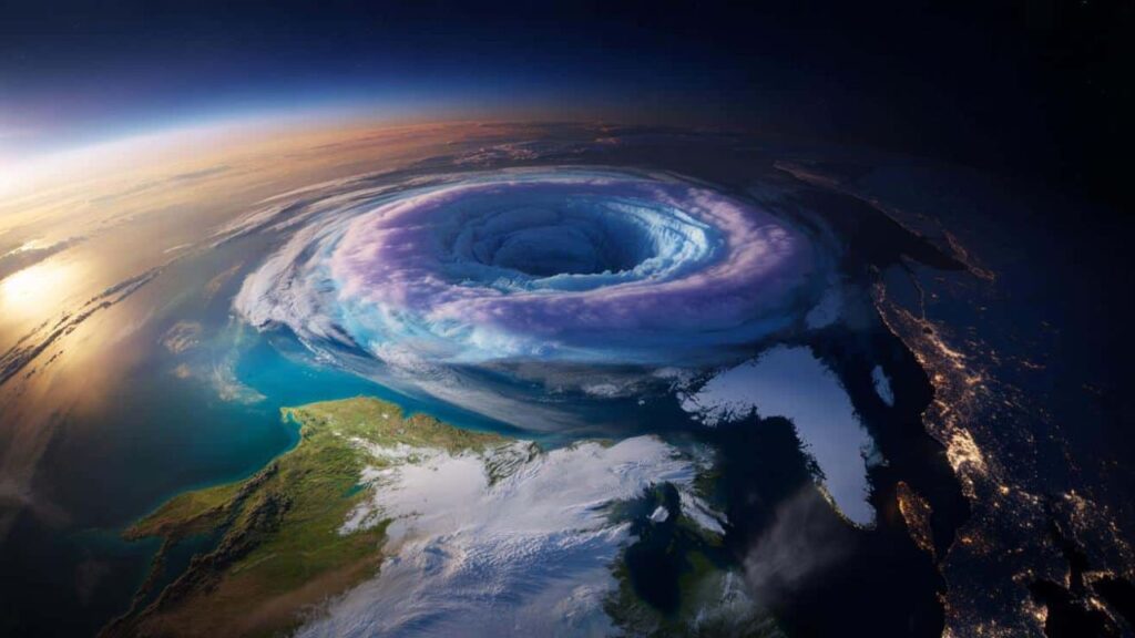
Meteorologists started posting images that made even seasoned weather-watchers pause. A warped, fractured ring of cold air hovering miles above the Arctic. The polar vortex, usually neat and contained, now looked like a cracked halo. Phrases like “record magnitude,” “disruption,” and “split event” began popping up in forecasts and late-night TV segments, paired with maps shaded in colors you don’t normally see this late in winter.

Something big is happening high above our heads. And it’s already bleeding into the weather we’re living with on the ground.
A polar vortex that doesn’t know what month it is
Think of the polar vortex as a massive whirlpool of frigid air spinning over the North Pole. In a typical winter, it stays relatively tight and centered, keeping the cold mostly locked up where it belongs. This year, that structure has been knocked badly off balance.
High in the stratosphere — about 10 to 30 miles up — a surge of energy from the lower atmosphere has slammed into the vortex, stretching it, weakening it, and in places, tearing it apart. Meteorologists call this a major stratospheric warming event, and what’s unusual isn’t just its strength, but its timing. Events this intense usually show up in January. Seeing one of this magnitude in February is what has forecasters using phrases like “rare” and “exceptional.”

On computer models, the vortex no longer looks like a clean circle. It’s dented, elongated, and flirting with a full split. When that happens, the jet stream — the fast-moving river of air that steers storms — starts to wobble instead of flowing smoothly west to east. Big loops form. Weather systems slow down. And cold air that normally stays bottled up near the pole can spill south in uneven bursts.
Why this creates weather whiplash on the ground
This is where it stops being an abstract science story and starts messing with daily life.
As the vortex weakens, winter loses its rhythm. One region might bask in near-record warmth while another deals with a sharp blast of Arctic air — sometimes within the same week. In early February, parts of the U.S. Midwest flirted with April-like temperatures, while sections of northern Europe were battered by relentless wind and rain. Meanwhile, the Arctic itself ran warmer than average, a detail that feels backward until you zoom out.

The disruption doesn’t guarantee one blockbuster snowstorm for everyone. Instead, it shifts probabilities. The atmosphere becomes jumpy. Forecasts stretch and snap. You get sudden thaws followed by flash freezes, rain that turns icy overnight, or cold snaps that arrive fast and leave just as abruptly.
According to the National Weather Service, these patterns often unfold over 10–20 day windows rather than neat, predictable stretches. That’s why forecasts lately seem to change their minds every few hours. The system steering them is literally wobbling.
For North America and Europe, the next few weeks are likely to feature sharp contrasts rather than steady conditions. One city’s Instagram-worthy snow day can coincide with another region dealing with flooded roads or unseasonable warmth. It’s not chaos everywhere at once — it’s a patchwork.
What forecasters are watching right now
Meteorologists aren’t guessing blindly here. They’re tracking how quickly this stratospheric disruption works its way down into the lower atmosphere, a process that can take one to three weeks. When it does, its influence becomes much more obvious at the surface.
Agencies like NOAA and the UK Met Office are closely monitoring jet stream shifts and temperature anomalies across the Northern Hemisphere. You’ll often see them cautioning that confidence drops after about 7–10 days — not because they don’t know what’s happening, but because disrupted patterns are inherently harder to pin down.
That’s also why forecasters keep urging people to focus on trends instead of single-day forecasts. Is your region trending colder and stormier? Or warmer and wetter? That big-picture direction matters more than whether it snows next Thursday.
What you can actually do with a forecast this wild
All the talk about stratospheres and vortex splits can feel far removed from your commute or heating bill. But this kind of disruption has very real, very practical consequences.
Start by thinking in windows, not individual days. Look at the next two to three weeks and ask what kind of swings your area is facing. If colder air is likely, check the basics early: your car battery, drafty windows, outdoor pipes. If freeze–thaw cycles are in play, ice becomes a bigger threat than snow — on walkways, roofs, and roads.
Energy use is another quiet factor. Sudden cold snaps tend to spike heating demand, sometimes stressing local power systems, especially in regions that don’t often see deep winter cold. Keeping an eye on usage and having a simple backup plan isn’t alarmist — it’s practical.
Just as important is how you consume weather news. Viral maps and apocalyptic headlines are designed to grab attention, not provide clarity. Local meteorologists, national weather agencies, and climate scientists who explain uncertainty are your best guides. NOAA’s Climate Prediction Center (https://www.cpc.ncep.noaa.gov), the UK Met Office (https://www.metoffice.gov.uk), and Environment Canada (https://www.canada.ca/en/environment-climate-change.html) are solid starting points.
As one European forecaster put it bluntly on social media this week: “This doesn’t promise disaster. It just loads the dice toward more extremes.”
A strange February that says more than we want to admit
A major polar vortex disruption this late in winter doesn’t mean the climate system is collapsing overnight. But it does highlight how fragile our old assumptions about seasons have become.
February used to feel like the long exhale of winter — still cold, but predictable. Events like this blur that sense of order. For some people, it will be a quirky memory: the winter when the weather app seemed permanently confused. For others, especially in vulnerable areas, it could mean burst pipes, crop stress, dangerous ice, or short-term power issues.
What unfolds next won’t be one clean headline. It will be a mosaic of experiences: a farmer watching frozen soil after an early thaw, a parent juggling surprise school closures, a commuter sliding on black ice under a bright blue sky. That’s where the real impact of this disruption lives — not just in the data, but in how it forces a quiet recalibration of what “normal winter weather” even means anymore.
Key takeaways at a glance
| Key point | What it means | Why it matters |
|---|---|---|
| Polar vortex disruption | A rare, intense weakening of Arctic cold-air circulation in February | Explains why forecasts feel unstable |
| Weather whiplash | Rapid shifts between cold, warmth, rain, and snow over weeks | Helps with planning and preparedness |
| Local focus | Regional impacts vary widely | Reduces anxiety and improves decision-making |
FAQs:
Is this polar vortex disruption caused by climate change?
Scientists say the polar vortex itself is a natural feature, but a warming Arctic and shifting atmospheric patterns may be influencing how often and when disruptions occur. The link is still being studied, but it sits within the broader context of global warming.
Does a disrupted polar vortex always mean a huge snowstorm where I live?
No. It increases the odds of extreme or unusual winter weather, but local outcomes depend on how the jet stream sets up over your region.
How long will the effects last?
Impacts typically emerge one to three weeks after the disruption begins and can influence weather through late February and into early March.